At the laboratory we develop tools and methods for the analysis, the evaluation and the design of urban transformation. In particular, we work on the implementation of different tools, that respond to the main research streams of:
- Simulation for Experiencing Urban Transformation
- Simulation for Social Innovation
- Simulation for Urban Transition
Main equipment
- Photo\video cameras and tripods
- 360 photocamera
- Micro-camera for physical models subjective video-recording
- Sound-recorder
- Luxometer
- Weather station
- Tavolo Luminoso
- Software for digital simulation
- Workstations dedicated to digital simulation
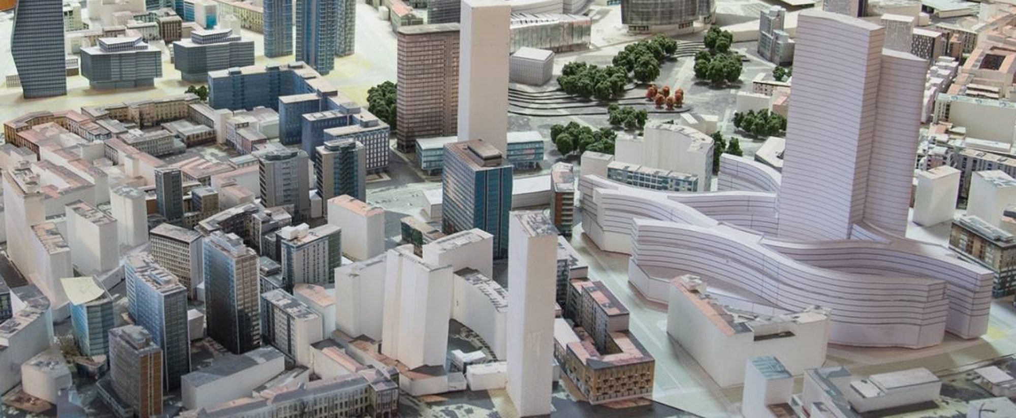
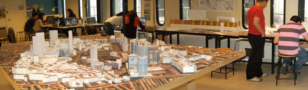
- Physical models of the Garibaldi-Repubblica area (scales: 1:100 1x1m – 1:500 3x4m -1:200 3x1m) and via Celoria – Città Studi area (1:200 3×0.5m)
Simulation for Experiencing Urban Transformation
Visualscapes
| Perceptual visual simulation 3D modelling Dynamic\interactive visual simulation of urban environments and design projects Videos with the superimposition of digital simulation of new design projects Virtual\Augmented Reality of the existing \simulated transformation Anticipation of users’ responses to transformed environments |
| Visual archives of urban spaces Visual simulation of urban environments Panoramas (180, 360) Sequences Videos |
| Immersive environments using game engines Immerisve visual and sound simulation of urban environments |
| Visibility Analysis Quantification of visible objects in the urban landscapes Degree of visibility of a selected object from the surrounding (e.g. an important view to preserve) Panoramas through isovists calculation Isovist properties computation (openess index of vistas, compactness, etc.) Lighting analysis on panoramas |
Soundscapes
| Perceptual sound simulation Perceptual sound simulation Reconstruction of soundscapes in the urban environment Simulation of future soundscapes in the urban environment |
Simulation for Urban Transition
Solar Accessibility
| Solar Access Solar accessibility maps of urban areas through hourly shadow maps (static maps and videos). Mean Shadow Density maps on open areas (i.e. superimposition of hourly shadow maps). Number of hours of direct sun (or accumulated shadow) on open areas, or roofs. Quantification of surfaces interested by direct sun or shadow (areas of interest). |
| Sky View Factor Sky View Factor maps. Quantification of sky view factor on the ground, on roofs, on the entire urban area. |
| Solar Envelopes Computation of the maximum buildable volume on site, on the basis of solar accessibility rules. Verification if design projects exceed the envelope and thus the solar rights of the existing fabric. |
| Solar Irradiation Solar irradiation maps of urban areas: hourly, monthly and yearly maps. Quantification of collected irradiation on surfaces (roof-sections, roofs, open spaces, etc.) |
Thermal Maps
| Heat maps Estimation of energy consumption and heating demand of the urban fabric: Quantification (estimation) of energy demand Maps |
| Thermal Discomfort Critical maps Critical maps showing potential thermal discomfort on open areas. The computation takes into account: solar irradiation on site, vegetation, albedo of urban materials (vertical and horizontal ), urban geometry (for instance urban canyons) |
Urban Morphometrics
| Urban Morphometrics Computation of urban indicators with a particular focus on urban form and energy aspects. Among the indicators, we consider the following: density and built volumes, permeability and urban coverage, urban blocks descriptors, urban form descriptors: surface to volume ratio, compactness index, urban canyon ratios, prevailing orientation of facades (vertical surfaces facing south) |
| Urban Accessibility and Connectivity Computation of urban accessibility and connectivity indicators of the street network: Connectivity indicators Accessibility indicators Centrality analysis and spatial analysis Ped-shed analysis: accessible areas within a 5 or 10 minutes walk |